WisGorgereduced
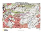
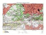
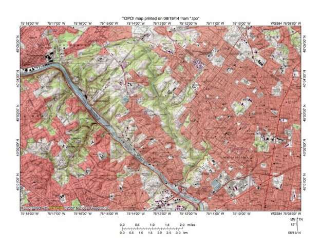
Figure 11: Reduced size topographic map showing the northwest Philadelphia area where the Schuylkill River and Wissahickon Creek have cut gorges across the 400-foot high complex of metamorphic and igneous rock. The Schuylkill River flows in a southeast direction and the south oriented Wissahickon Creek gorge is located near the map center. Note how tributary valleys are oriented in southwest and northeast directions on both sides of both the Wiisahickon and the Schuylkill valleys. This northeast to southwest tributary orientation is evidence large volumes of southwest oriented water flowed across the region as both the Wissahickon Creek gorge and the Schuylkill River gorge were being eroded. Wissahickon Creek valley headward erosion beheaded southwest oriented flow routes to the actively eroding Schuylkill River valley. United States Geological Survey map presented using National Geographic TOPO software.