
← back to “A9Gorge entrance”
A9Gorge entrance
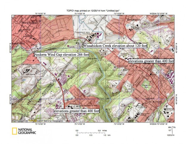
Figure 14: North entrance to the Wissahickon Creek gorge at the Philadelphia city line. The city line is marked and extends in a northeast direction from near map southwest corner to just east of the map north center edge. Wissahickon Creek is flowing at an elevation of approximately 120 feet where it enters the gorge. Elevations greater than 400 feet can be found on either side of gorge meaning the gorge is approximately 300 feet deep. The marked Andorra Wind Gap links the valleys of a northeast oriented Wissahickon Creek tributary and a southwest oriented Schuylkill River tributary and has an elevation of 266 feet. United States Geological Survey map presented using National Geographic TOPO software.
