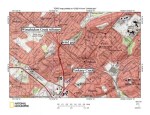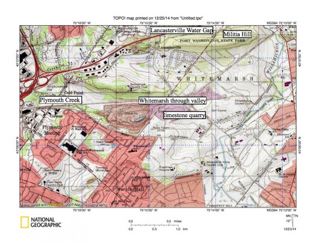
A8Whitemarshvalley
Figure 12: Whitemarsh Valley just north of the metamorphic and igneous rock ridge through which the Wissahickon Gorge is cut. Wissahickon Creek flows in a south direction near the east edge of the map across the Whitemarsh Valley to reach the gorge entrance seen in figure 14.
Plymouth Creek drains in a south and southwest direction to eventually reach the Schuylkill River (upstream from the Schuylkill River gorge). The Whitemarsh through valley near the map center links the Wissahickon Creek valley with the Plymouth Creek valley and has an elevation of 206 feet where the railroad crosses the drainage divide (just north of the limestone quarry). The entire Whitemarsh Valley area is lower in elevation than crest elevations on the metamorphic and igneous rock ridge through which the downstream Wissahickon Creek gorge is cut. United States Geological Survey map presented using National Geographic TOPO software.