
← back to “A6Ambler Water Gap”

A6Ambler Water Gap
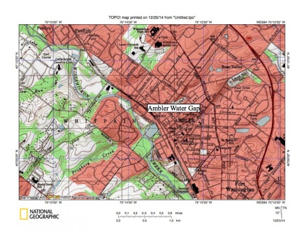
Figure 8: Wissahickon Creek flows in a southeast direction across low southwest to northeast oriented ridges in the Ambler region. Northeast oriented tributaries, including Prophecy Creek, from the southwest join Wissahickon Creek as barbed tributaries while southwest oriented tributaries flow to Wissahickon Creek from the northeast. The northeast and southwest orientation of tributaries in the Ambler region provide evidence the Wissahickon Creek valley eroded headward across multiple southwest oriented flow channels. United States Geological Survey map presented using National Geographic TOPO software.
