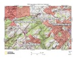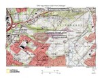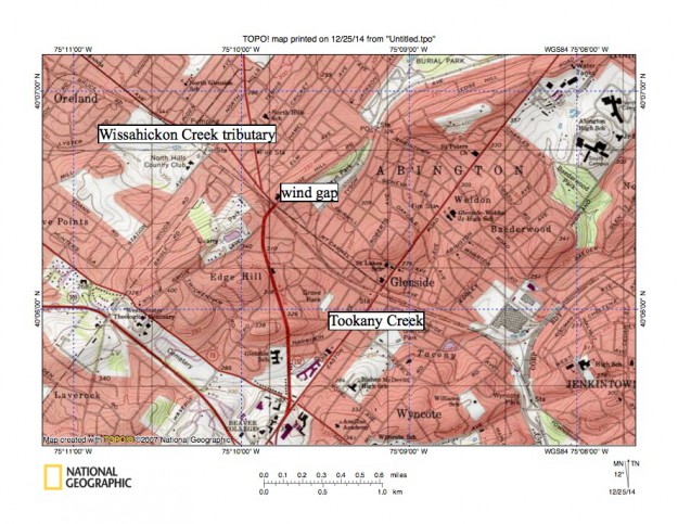
A13Tookanycreek
Figure 13: South and east of figure 12 is the Wissahickon Creek-Tookany Creek drainage divide. Tookany Creek becomes Tacony Creek and then Frankford Creek as it flows in a south direction from Glenside to the Delaware River. The railroad line from Oreland (near northwest corner of map) to Jenkintown passes through a wind gap linking headwaters of a west oriented stream which joins south oriented Wissahickon Creek in the Whitemarsh Valley with the east and south oriented Tookany-Tacony-Frankford Creek valley. The wind gap elevation today is about 320 feet, although the railroad may have lowered the elevation by ten or more feet. The highway near the Westminster Theological Seminary (southwest quadrant of map) passes through a wind gap with an elevation of approximately 350 feet. These and other wind gaps demonstrate that water once flowed from the Wissahickon Creek drainage basin to the Tookany-Tacony-Frankford Creek drainage basin and then to the Delaware River. Elevations surrounding the Wissahickon Gorge to the west of figure 13 are at least 50 feet higher than elevations in these wind gaps. United States Geological Survey map presented using National Geographic TOPO software.