
← back to “A11Monoshonecreek”
A11Monoshonecreek
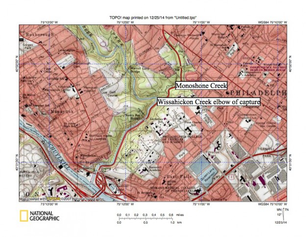
Figure 15: Wissahickon Creek elbow of capture at Monoshone Creek and the Wissahickon Creek confluence with the Schuylkill River. United States Geological Survey map presented using National Geographic TOPO software.
